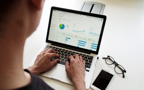
Introduction to GPS Technology
Welcome to the fantastic world of GPS technology! GPS has become an integral part of our everyday lives in today’s fast-paced and interconnected world. It’s hard to imagine when we didn’t have this powerful tool guiding us, tracking our movements, and connecting us to the world. From navigation systems in our cars to fitness trackers on our wrists, GPS is everywhere – quietly working behind the scenes to make our lives easier and more efficient.
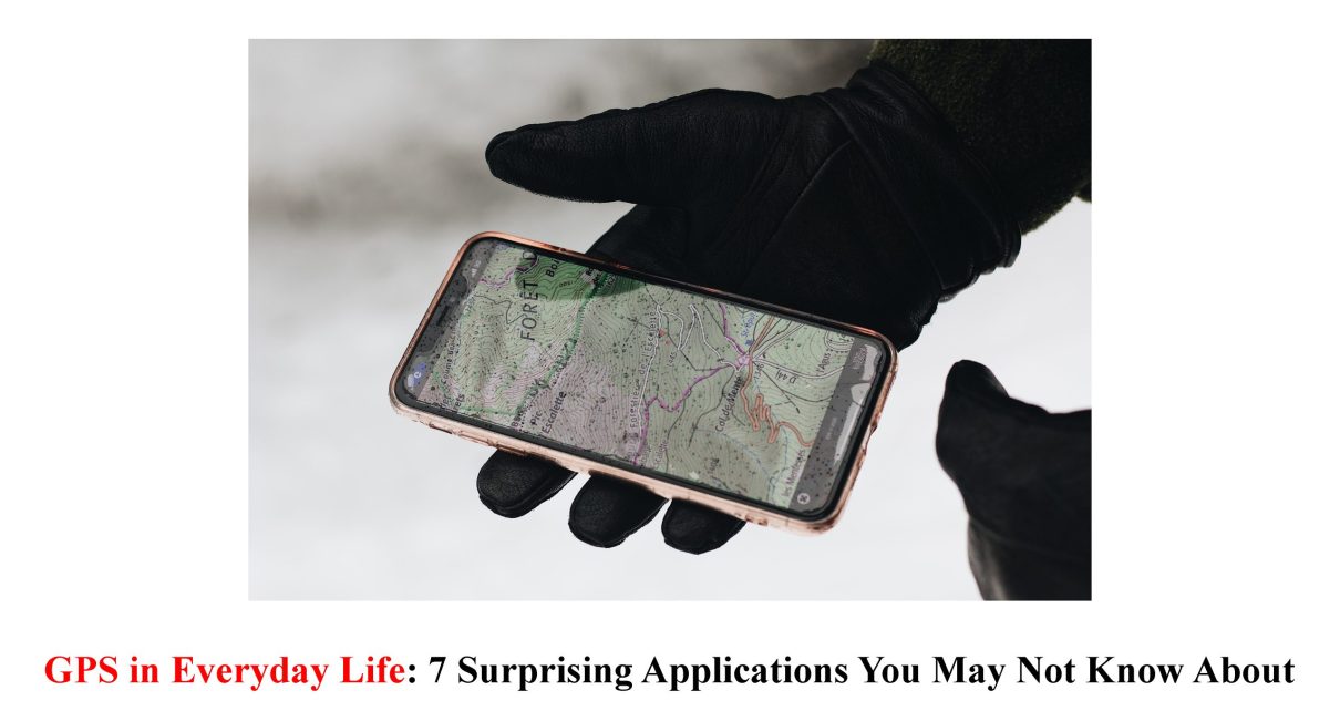
But did you know that countless surprising applications of GPS go beyond just getting from point A to point B? In this blog post, we’ll explore seven unexpected ways GPS technology shapes our daily experiences. So buckle up and prepare for a journey into the fascinating realm of GPS innovations!
Navigation and Transportation
GPS technology has revolutionised how we navigate and travel, making it easier than ever to reach our destinations. Whether driving in a new city or exploring unfamiliar hiking trails, GPS provides accurate directions and real-time updates. No more relying on outdated maps or asking for directions from strangers!
For drivers, GPS devices have become essential for getting from point A to point B. With voice-guided turn-by-turn instructions, you can avoid wrong turns and traffic jams, saving time and frustration. And with features like lane guidance and speed limit alerts, GPS keeps us safe on the road.
But navigation isn’t limited to just cars. GPS is also employed in other modes of transportation, such as aeroplanes, ships, and trains. Pilots rely on GPS for precise positioning during flight, while ship captains use it to navigate through vast oceans.
Even pedestrians benefit from GPS technology through smartphone apps that provide walking directions. These apps guide us and offer alternative routes based on live traffic data.
Moreover, ridesharing services like Uber use GPS to accurately match passengers with nearby drivers. This ensures faster pickups and reduces waiting times significantly.
In short, GPS has transformed how we move around in our everyday lives – whether by car or foot – providing convenience and efficiency at every journey step!
Fitness and Health Tracking
In today’s fast-paced world, staying fit and healthy has become a top priority for many people. And thanks to GPS technology, tracking our fitness activities has never been easier or more accurate.
With the help of GPS-enabled devices such as smartwatches or fitness trackers, we can now monitor our daily steps, distance covered, calories burned, and even heart rate – all in real time! This data allows us to set goals, track progress, and adjust our exercise routines for better results.
But it doesn’t stop there. GPS technology also enables us to map out running routes or cycling trails based on distance and elevation. Whether exploring new neighbourhoods or sticking to your favourite paths, knowing exactly where you’ve been can provide motivation and a sense of accomplishment.
Furthermore, some advanced fitness trackers use GPS to analyse sleep patterns. By monitoring movement during the night, these devices can determine the quality of your sleep cycle and offer insights into how to improve it.
Additionally,
GPS plays a crucial role in outdoor activities like hiking or trail running. It provides hikers with accurate location information to stay on course and safely reach their destinations.
For those who enjoy water sports like kayaking or stand-up paddleboarding, GPS technology is used in waterproof trackers that measure speed and distance travelled over water bodies, ensuring an enjoyable yet safe experience.
Moreover, GPS is integrated into several popular health apps that allow users to track their nutrition intake by providing recommendations based on dietary requirements while suggesting nearby restaurants. This makes it easier for individuals with specific health goals, such as weight loss or muscle gain, to make informed choices when dining out.
In conclusion,
Integrating GPS technology into fitness and health tracking has revolutionised how we approach wellness. With its ability to accurately measure physical activity levels, provide navigation assistance during outdoor adventures, and even offer personalised recommendations for healthier living.
Many people use GPS-enabled devices and apps to optimise their fitness journeys. So
Location-based Social Media
Location-based social media has taken the world by storm, revolutionising the way we connect and share our experiences with others. With the help of GPS technology, these platforms allow us to stay connected virtually, explore new places, and discover hidden gems in our neighbourhoods.
One popular location-based social media app is Foursquare. This app allows users to “check in” at various locations, such as restaurants, parks, or museums, sharing their whereabouts with friends and followers. It’s a great way to see where your friends are hanging out or get recommendations for nearby attractions.
Another example is Snapchat’s geofilters feature. Using GPS data, Snapchat can overlay fun filters onto your photos based on location. Whether visiting a famous landmark or attending a local event, these filters add a touch of creativity to your snaps.
Instagram also utilises GPS technology through its “Explore” tab. By analysing your location data and preferences, Instagram suggests posts from people in your area or highlights popular spots nearby. It’s a fantastic way to discover trending restaurants or picturesque locations for that perfect photo opportunity.
Furthermore, apps like Yelp use GPS technology to provide personalised recommendations for restaurants and businesses in your vicinity. These apps consider factors like reviews, ratings, distance from you and even special offers available at each place.
Social media and GPS technology have opened up endless possibilities for connecting with others while exploring the world around us. From checking in at trendy cafes to discovering off-the-beaten-path destinations through Instagram geotags – location-based social media keeps us informed about what’s happening right under our noses!
So next time you find yourself scrolling through Facebook or posting pictures on Instagram – remember that behind all those likes and comments lies the power of GPS technology, making it all possible!
Emergency Services and Disaster Relief
In times of crisis, GPS technology is vital in ensuring the safety and well-being of affected communities. GPS has revolutionised how we handle emergencies, from coordinating emergency response efforts to providing real-time updates on disaster situations.
One application of GPS in emergency services is for search and rescue operations. By tracking the location of lost or distressed individuals, rescuers can quickly pinpoint their whereabouts and assist. This is particularly useful in remote areas where traditional landmarks are unavailable.
Furthermore, GPS enables effective evacuation planning by mapping out safe routes and identifying potential bottlenecks or hazards. Emergency management agencies can use this information to efficiently coordinate evacuations and ensure people reach designated shelters or safe zones without delays.
Another vital use of GPS technology during disasters is for damage assessment. By using satellite imagery combined with GPS data, authorities can assess the extent of destruction caused by natural disasters such as earthquakes or hurricanes. This information helps prioritise rescue operations and allocate resources effectively.
Additionally, GPS plays a crucial role in coordinating humanitarian aid delivery during emergencies. Aid organisations rely on accurate location data provided by GPS to navigate through affected areas and distribute supplies to those in need. This ensures timely assistance reaches the right places, maximising relief efforts.
GPS also facilitates communication among first responders during emergencies through mobile devices equipped with location-tracking capabilities. This improves coordination between teams operating at various locations, improving overall response efficiency.
In conclusion,
The applications of GPS technology in emergency services and disaster relief are extensive and continue to evolve as new advancements are made. From search and rescue missions to efficient evacuation planning, from damage assessment to aid distribution coordination – every aspect benefits from incorporating precise positioning systems into emergency management strategies. As technology progresses, we can expect even more innovative uses of GPS that will ultimately save lives during critical situations.
Agriculture and Farming
Agriculture and farming have always been vital to human survival, but with technological advancements, GPS plays a crucial role in improving efficiency and productivity.
One surprising application of GPS in agriculture is precision farming. Farmers can now use GPS-enabled tractors and machinery to navigate their fields precisely, ensuring accurate planting and fertilisation. This saves time and reduces waste by targeting specific areas that require attention.
GPS also enables farmers to monitor soil moisture levels remotely using sensors connected to satellites. This data helps them make informed irrigation decisions, leading to optimal water usage and healthier crops.
Livestock management has also benefited from GPS technology. Ranchers can track the location of their animals using GPS collars or ear tags, allowing them to optimise grazing patterns and prevent loss by quickly locating any straying livestock.
Furthermore, drones equipped with GPS are being used for aerial surveillance of crops. They can identify areas affected by pests or diseases early on, enabling farmers to take immediate action before significant damage occurs.
In addition, precise mapping provided by GPS allows farmers to analyse field conditions such as slope and elevation differences accurately. This information aids in planning crop rotations and optimising field layouts for maximum yield potential.
With these innovative applications of GPS technology in agriculture and farming, it’s clear that it plays a fundamental role in revolutionising the industry. By harnessing the power of satellite navigation systems, farmers can increase productivity while reducing environmental impact—a win-win situation for producers and consumers alike!
Wildlife Conservation
The use of GPS technology in wildlife conservation has revolutionised the way we monitor and protect endangered species. By tracking animal movements, researchers can gain valuable insights into their behaviour, habitat preferences, and migration patterns.
Previously, studying wildlife meant physically following animals or relying on unreliable manual data collection methods. But with GPS trackers attached to collars or tags, scientists can remotely monitor animals’ locations in real-time.
This information is crucial for understanding how ecosystems function and identifying areas that need protection. For example, by tracking the movements of elephants in Africa using GPS devices, conservationists can identify key migratory corridors and establish protected areas along these routes.
GPS technology also helps combat illegal activities such as poaching. By monitoring the movements of critically endangered species like rhinos or tigers through GPS tracking devices, authorities can respond quickly to any suspicious activity within protected areas.
Furthermore, GPS-enabled drones are being used to survey remote regions and collect data on wildlife populations more efficiently than ever. These aerial surveys provide essential information about population sizes and distribution patterns without disturbing fragile ecosystems.
Integrating GPS technology into wildlife conservation efforts has dramatically enhanced our ability to understand and protect vulnerable species. With continued advancements in this field, we hope to see even more significant successes in preserving biodiversity for future generations.
Conclusion: The Growing Impact of GPS in Our Daily Lives
As we have explored the various applications of GPS technology, it becomes evident that its impact on our daily lives is growing exponentially. GPS has become an indispensable tool in numerous industries, from navigation and transportation to fitness tracking and wildlife conservation.
With GPS, we can navigate through unfamiliar territories effortlessly, saving time and reducing stress. It has revolutionised travel by providing real-time traffic updates and suggesting alternative routes. We no longer need to rely solely on paper maps or ask strangers for directions – glancing at our smartphone or car’s dashboard is all it takes.
Moreover, integrating GPS into fitness trackers has transformed how we monitor our health and exercise routines. By accurately tracking our movements, distance travelled, and calories burned, GPS-enabled devices help us stay motivated and achieve our fitness goals. Whether running outdoors or cycling along scenic routes, GPS keeps us informed about our progress every step of the way.
GPS also plays a significant role in location-based social media platforms. With apps like Foursquare or Yelp using geolocation services powered by GPS technology, users can discover nearby restaurants, landmarks, and events and share their experiences with friends. This enhances our social interactions and helps local businesses thrive by attracting more customers.
GPS proves to be a lifesaving tool in emergencies or natural disasters.
With accurate satellite location data, rescue teams can quickly locate lost, injured, trapped or stranded individuals.
GPS enables faster response times, saving precious moments that could mean the difference between life and death.
In addition, GPS aids disaster relief efforts by precisely mapping affected areas, enabling efficient distribution of resources to those in need.
The impact of GPS extends even further into unexpected areas such as agriculture.
With precision farming techniques, satellite-based positioning systems allow farmers to optimise crop yields, minimise waste, and reduce environmental impact.
By analysing data collected from GPS-enabled equipment, farmers can make informed decisions regarding irrigation,